
FTP Developer Guide for GPS Toll Verification
Intended Audience
Developers who want to upload GPS data for tolls verification using PrePass GPS Tolls FTP solution.
Alternately, carriers may leverage the PrePass GPS Tolls API to share their GPS data via API.
Access
Access may be obtained from your account manager, or through PrePass customer service.
Connection
Connect to ftp.prepass.com with the credentials provided by PrePass.
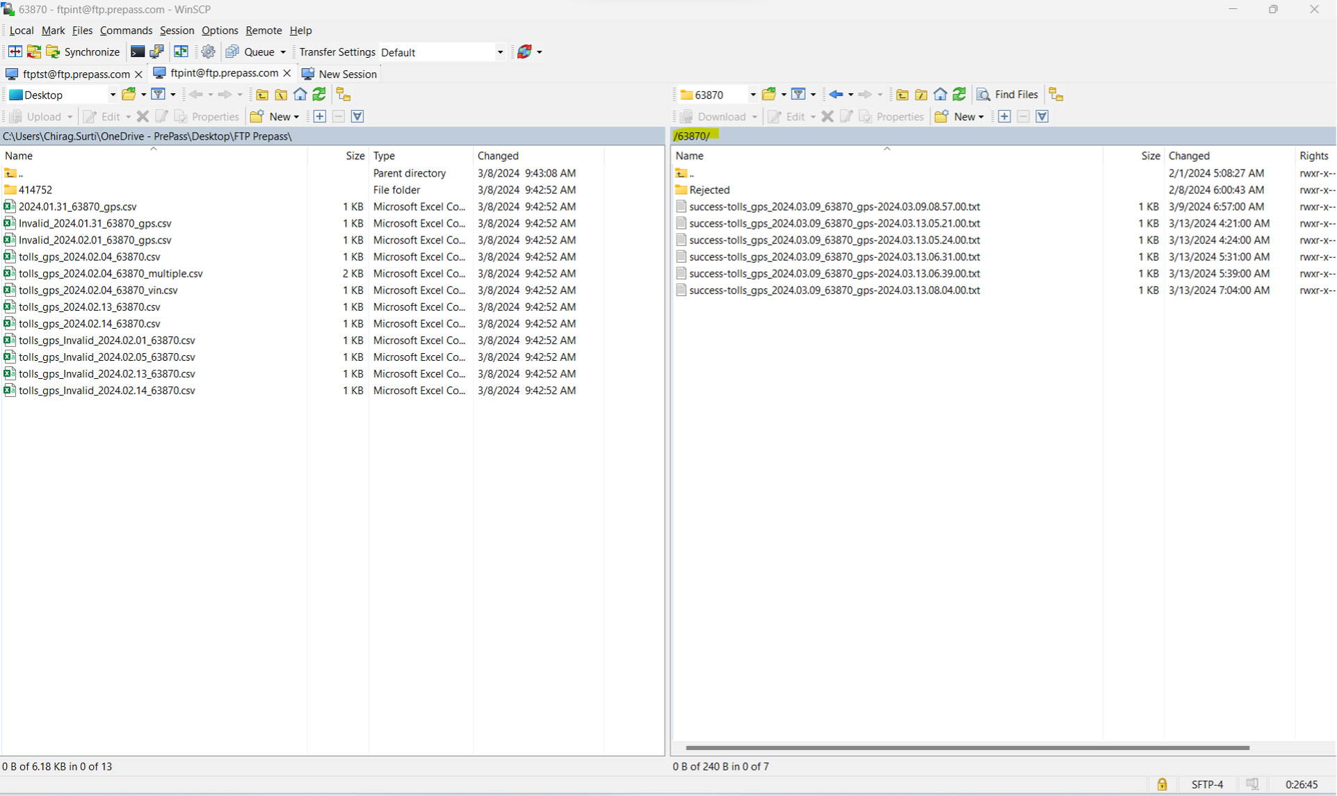
Your default FTP folder will be your PrePass account number.
If the folder name does not match your account number, please notify your account manager or PrePass customer service.
Tolls GPS CSV File Format and Data Contracts
You may generate a GPS data file for one or multiple vehicles.
FTP file and filename format: tolls_gps_<*unique*>.csv
Your GPS data file name should conform to the above naming convention. The file name may contain designations specific to your organization, but the filename has to
Begin with “tolls_gps_”
Contain a unique alpha-numeric identifier that you set, such as account number, date and vehicle information, and
End with a .csv file type.
File format is comma separated values, or csv.
GPS Data CSV Row Format
Field Name
Example
Required
Description
DeviceNumber
06XXXXX73
Required if VIN not present
It can be either the transponder Id or the Mobile device Id assigned to the account
VIN
1X**D*&67D*8****7
(17 digit Valid VIN)
Required if Device Number not present
Vehicle Identification Number
PlateNumber
JD*8*P
Optional
Vehicle plate number
PlateState
CA
Optional
State abbreviation
TotalAxleCount
4
Optional
Latitude
[-90, 90]
i.e.: 30.213333
Required
The latitude of the geographical coordinate.
Longitude
[-180, 180]
-112.23232
Required
The longitude of the geographical coordinate.
Timestamp
Epoch
i.e.: 1687979999
Required
The epoch time (or Unix time) is the number of seconds that have elapsed since January 1, 1970 (midnight UTC/GMT)
Timezone
i.e.: -14400
Required
Speed
[0,60]
i.e.: 25.9
Optional
The instantaneous speed of the device, measured in meters per second.
DirectionOfTravel
[0,180] *depends on platform.
i.e.: 360
90
Optional
The direction in which the device is traveling, measured in degrees and relative to due north.
GpsLocationAccuracy
*Meters or Percentage?
5.23
Optional
The accuracy of a geographical coordinate, measured in meters. *We recommend using signals with no more than a 20m radius for the best results.
Example CSV - Single Vehicle
DeviceNumber, Vin, PlateNumber, PlateState, TotalAxleCount, Latitude, Longitude, Timestamp, Timezone, Speed, DirectionOfTravel, GpsLocationAccuracy
06XXXXX7,1X**D*&67D*8****7,J*5*HP,CA,4,30.213333,-112.23232,1687979999,-14400,25.9,37.99,5.23
Example CSV - Multiple Vehicles
DeviceNumber, Vin, PlateNumber, PlateState, TotalAxleCount, Latitude, Longitude, Timestamp, Timezone,Speed, DirectionOfTravel, GpsLocationAccuracy
06XXXXX7,1X**D*A67D*8****7,J*5*HP,CA,4,30.213333,-112.23232,1687979999,-14400,25.9,37.99,5.23
07XXXXX2,1P**D*B21D*8****7,K*6*FA,CA,4,30.213333,-111.23232,1687979999,-14400,25.9,37.99,5.23
Transfer GPS CSV File Using FTP Client
Once Tolls GPS data files are ready, the next step is to upload for processing.
FTP File Upload
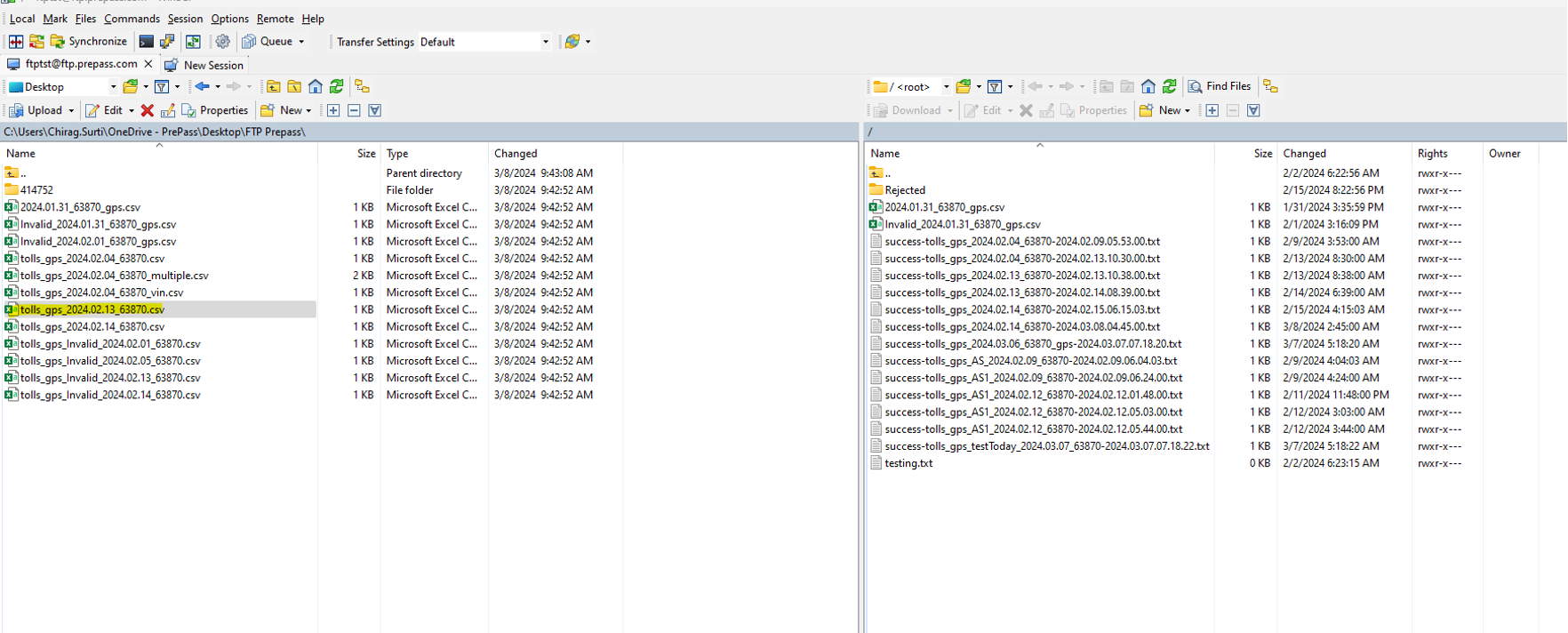
Figure 2 - Upload tolls GPS CSV file to specific FTP location.
FTP File Processor
The FTP File processor will process all uploaded GPS data files.
Output of FTP file processor can be success or failure as outlined below.
FTP Success
A successfully processed input file will be removed from the folder location and a success status file will be generated for each respective input file.
File Name: success-<original file name>-<processing date>.txt
Content: Successfully processed vehicle GPS data.
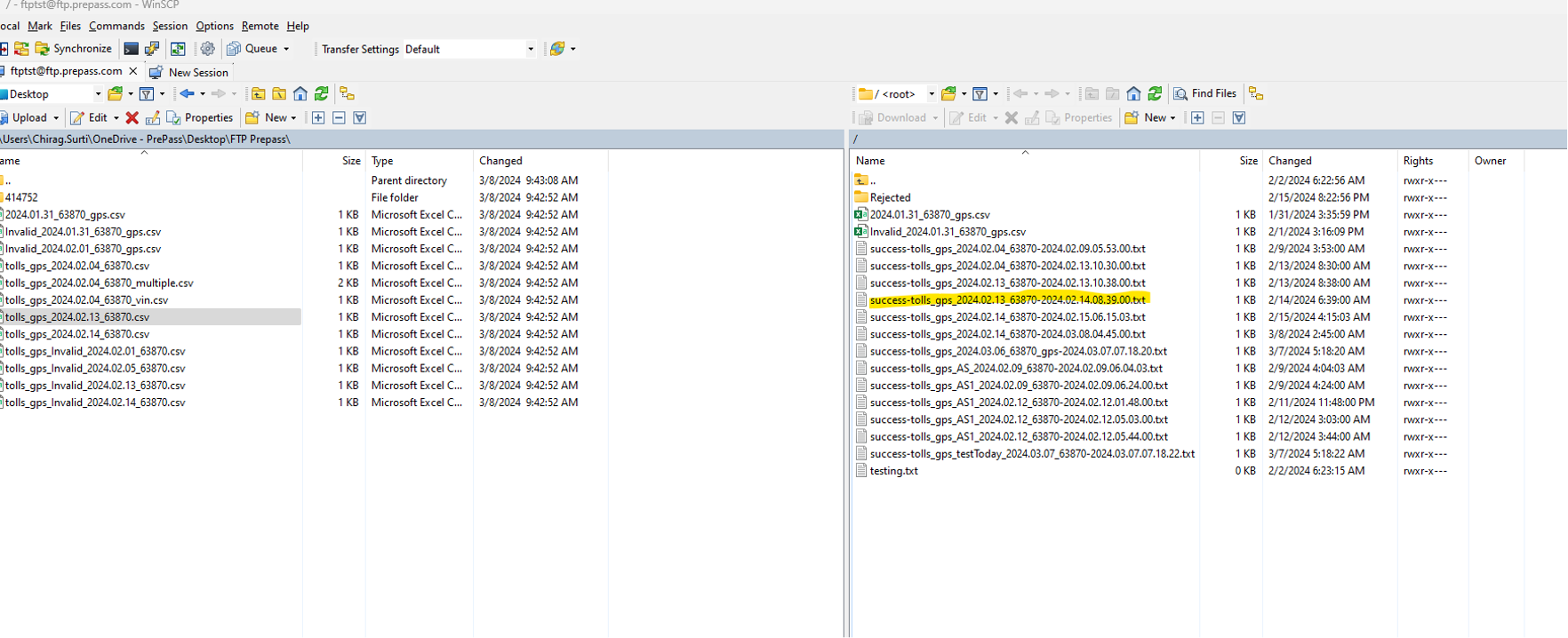
Figure 3 - Successful status file
FTP Failure
If input validations fail within a given input file, that file will be removed from the input folder and placed in the “Rejected” folder.

Figure 4 - Rejected folder.

Figure 4 - Original GPS data file moved to Rejected folder.
There will also be a corresponding failure status file placed in the “Rejected” folder, which will contain further information about the specific processing errors in the input file.
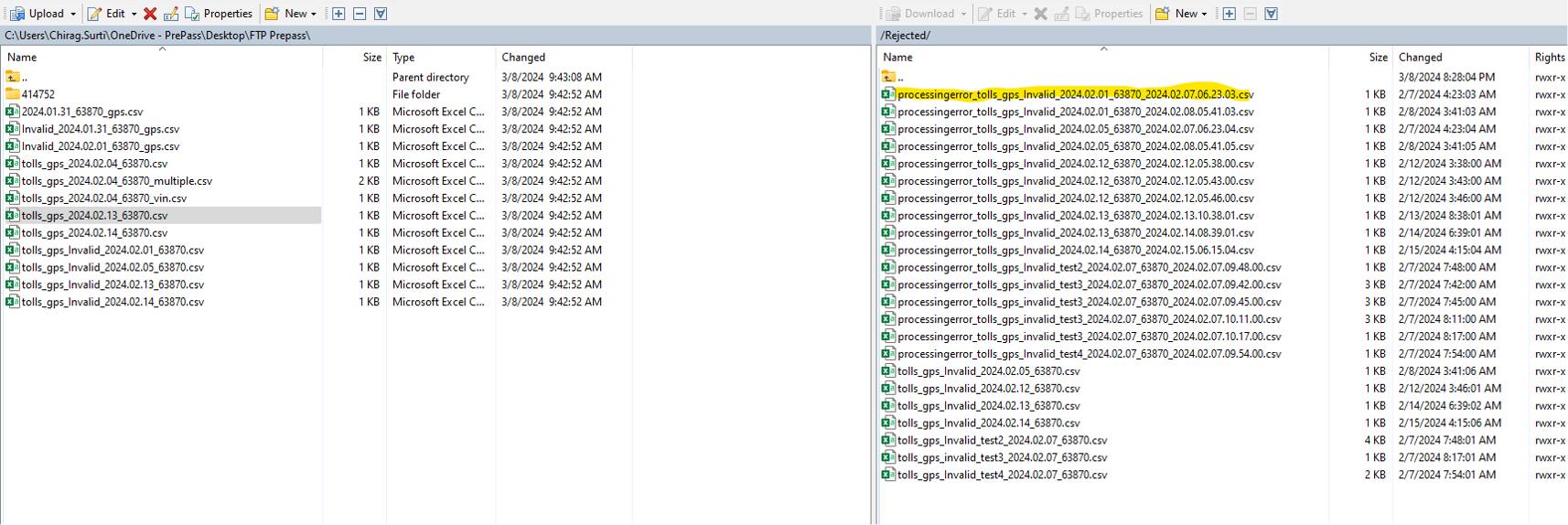
Figure 5 Failed status file.
File Name: processingerror_<original file name>_<processing date>.csv
Content: CSV file with
Heading
Heading
ErrorLineNumber
Line number of original csv file
ErrorMsg
Error message for specific fields which are invalid.
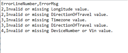
Figure 6 Processing error file contents
© 2025 PrePass